

PROTECT YOURSELF with Orgo-Life® QUANTUM TECHNOLOGY
Orgo-Life the new way to the future Advertising by Adpathway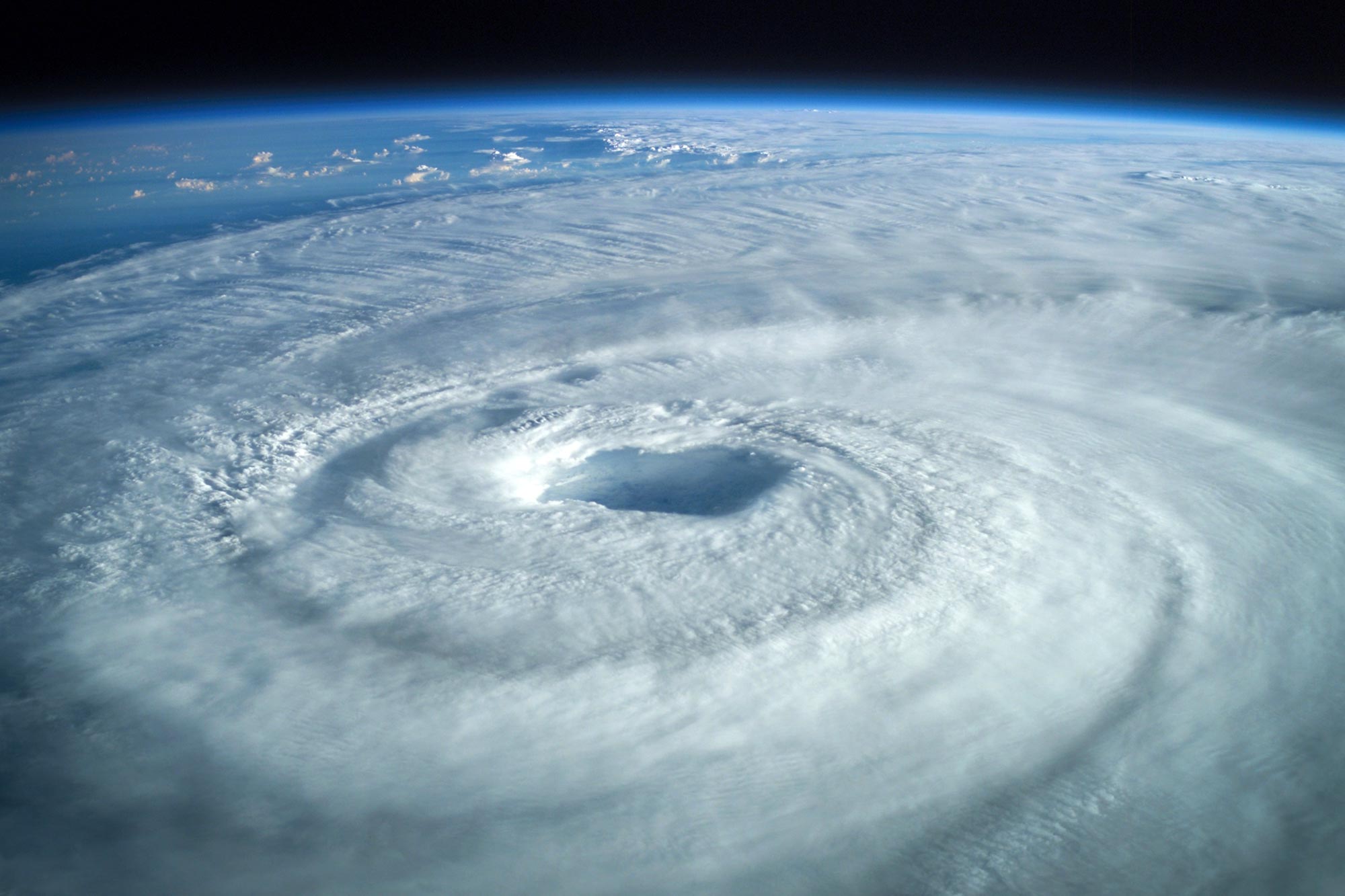 Hurricanes are powerful tropical storms capable of producing destructive winds, storm surge, flooding, and tornadoes across large areas. Their impacts can extend far inland, making clear forecasts and timely preparation essential for reducing risk. Credit: Shutterstock
Adding inland information improved recognition of hurricane watches but did not fully solve how people understand and respond to storm risk.
Hurricane forecasts can only protect people if the danger shown on the screen is clear enough to understand and act on. Researchers at Florida State University examined whether a redesigned hurricane forecast graphic can better communicate risks that extend well beyond the coast.
Faculty from FSU’s School of Communication in the College of Communication and Information and the Department of Geography evaluated an experimental National Hurricane Center (NHC) graphic that adds inland tropical storm and hurricane watches and warnings to the familiar track forecast cone, which has traditionally emphasized coastal threats.
The updated format, introduced by the NHC in 2024, helped people without meteorological expertise identify inland areas under hurricane or tropical storm watches. However, it did not change how participants perceived their risk or whether they intended to take protective action, and it did not improve their ability to recognize areas under warnings. The findings were published in the American Meteorological Society journal Weather, Climate, and Society.
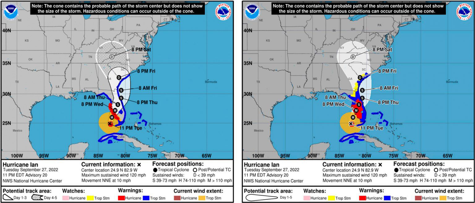 Examples of two track-forecast cones compared in the study. On the left is an operational, coastal-only “cone of uncertainty” for Hurricane Ian, which made landfall in September 2022. On the right is a new, experimental track-forecast cone developed by the National Hurricane Center. Credit: Florida State University
“The National Hurricane Center has made a number of thoughtful changes to improve how hurricane information is communicated,” said Assistant Professor Elizabeth Ray, the study’s lead author. “We had a simple question. Do those changes actually help people understand what the graphic is telling them about the risk they face?”
 Assistant Professor Elizabeth Ray. Credit: Florida State University
Inland watches became easier to identify
To find out, the researchers showed participants in Florida and Georgia either the traditional hurricane cone or the experimental version containing additional inland information. People who saw the revised graphic were more successful at identifying locations under tropical storm or hurricane watches. That greater understanding, however, did not lead them to perceive more danger or become more likely to plan protective actions. A persistent obstacle is confusion over what the familiar “cone of uncertainty” actually means.
“For years, research has shown that people often mistake a wider cone for a bigger storm,” Ray said. “Our findings suggest that even with an updated graphic, that misconception can be hard to shake.”
Inland hazards remain hard to communicate
The NHC developed the revised graphic to make hazards such as flooding, tornadoes, and damaging winds farther inland more visible. By placing inland hurricane and tropical storm information directly onto the familiar forecast cone, the design is intended to reinforce that dangerous hurricane effects can reach communities far from the coastline.
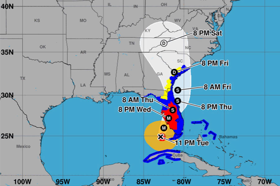 An inland experimental track forecast cone with watches/warnings depicted over affected inland areas. Credit: Florida State University
The researchers stress that their results do not question the quality of NHC forecasting, which they describe as highly accurate. The challenge instead lies in turning sophisticated scientific information into a format that people can rapidly interpret and use when deciding how to respond.
 Professor Patrick Merle, director of the School of Communication. Credit: Florida State University
“Our question wasn’t whether the science is good,” said co-author Patrick Merle, professor and director of the School of Communication. “The science is excellent. The question is how we communicate that science so people who aren’t meteorologists understand the risk they’re facing.
If people find information credible but still don’t understand it well enough to take protective action, then communication has fallen short. The goal is to empower people with information they can use to stay safe.”
Local forecasts add crucial context
Rather than depending on the hurricane graphic by itself, the researchers recommend combining it with local forecasts and information describing the specific impacts expected in a community.
“Our findings are a reminder that one graphic can only tell you part of the story,” Ray said. “Don’t rely on the cone alone. Pair it with clear, local information about what impacts to expect and what actions to take. That gives you a fuller picture of what the storm could mean where you live and what to do next.”
Reference: “Uncertain about the New Cone? How Nonexperts Perceive NHC’s Experimental Track-Forecast Product” by Elizabeth C. Ray, Patrick F. Merle and Bradford Johnson, 6 August 2026, Weather, Climate, and Society.
DOI: 10.1175/WCAS-D-25-0158.1
Never miss a breakthrough: Join the SciTechDaily newsletter.
Follow us on Google and Google News.











 English (US) ·
  French (CA) ·
  French (FR) ·