
 1 month ago
2
1 month ago
2
PROTECT YOUR DNA WITH QUANTUM TECHNOLOGY
Orgo-Life the new way to the future Advertising by Adpathway Image source, EPA
Temperature could reach 30C on Friday sparking big thunderstorms
Chris Fawkes
Lead Weather Presenter
The first yellow heat-health alerts have been issued for 2025 while the Met Office is also warning of thunderstorms which will bring frequent lightning, gusty winds, hail and torrential downpours.
Some communities could be hit with more than half a month's worth of rain in the space of a few hours, with some flash flooding likely from the biggest storms.
The health alerts, issued by the UK Health Security Agency (UKHSA),, external cover the east of England, London, East Midland and south-east England from 21:00 BST on Thursday until 08:00 on Sunday.
Temperatures are expected to surge to 30C (86F) in parts of eastern England with the heat and humidity combining to bring thunderstorms.
The health alert means that there is likely to be increased use of health care services by vulnerable people and an increase in risk to health for people aged over 65 years or with pre-existing health conditions, including respiratory and cardiovascular diseases.
The UK is currently caught in a weather battle zone between high pressure to the east and low pressure to the west, with southerly winds send increasingly humid air across the country.
When do the storms start?
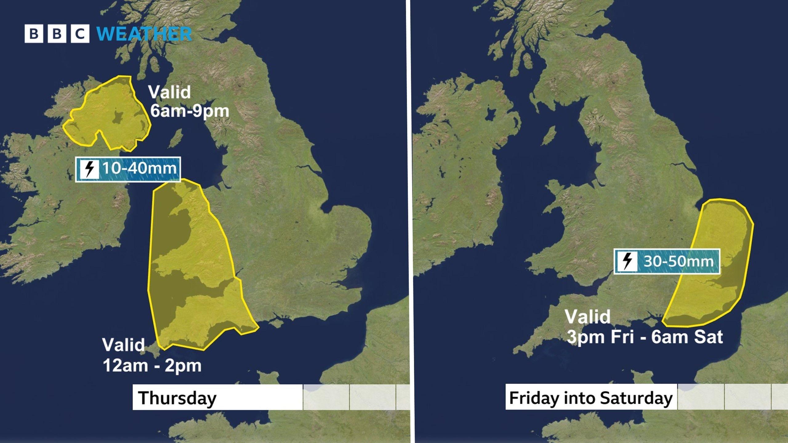
Yellow warnings for thunderstorms for the next few days
The first batch of thunderstorms will develop on Wednesday night. The Met Office has issued a yellow weather warning for south-west England and Wales, from midnight to 13:00 BST on Thursday.
An additional yellow weather warning for Northern Ireland is valid between 06:00 and 21:00 on Thursday.
The amount of rain will vary from one place to the next, but some areas could have as much as 10-20mm in an hour, or 30-40mm (1-1.5in) in three hours, which could cause some flash flooding.
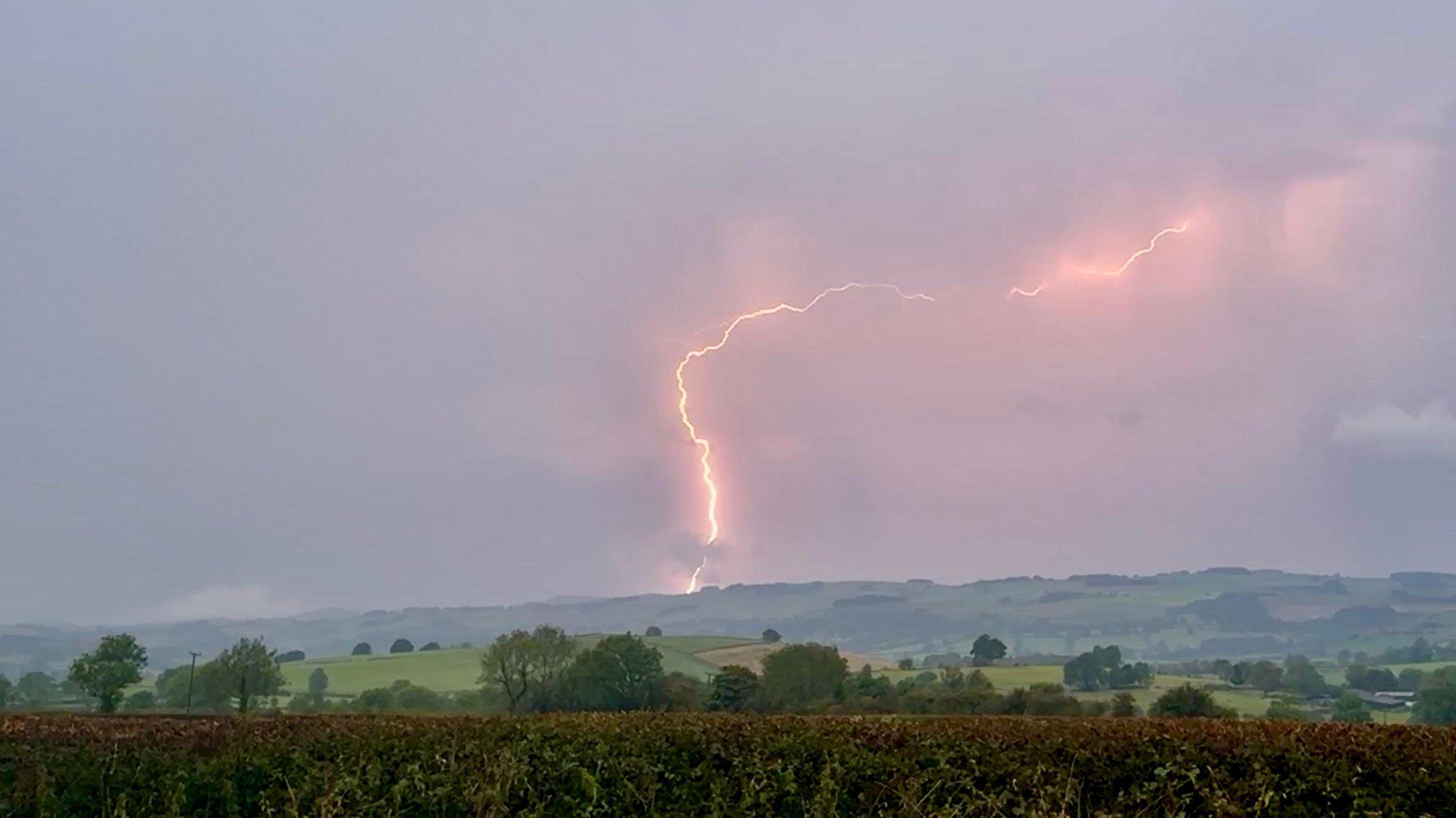 Image source, BBCWeatherWatcher/ Head-in-the-Clouds
Fork-lightning tears across the sky in Hognaston, Derbyshire
Another round of storms will develop in the south late on Friday before spreading northwards across most of the UK during Friday night and into Saturday.
The Met Office has issued a yellow thunderstorm warning for south-east England and East Anglia from 15:00 on Friday to 06:00 on Saturday.
The amount of rain once again will vary greatly from one area to the next, but some of the storms could bring torrential downpours with up to 30-50mm (1-2in), well over half a month's worth of rain, leading to some flash flooding. Some people may also experience gusty wind and large hail.
Storms driven by a Spanish Plume
These thunderstorms are associated with a Spanish Plume event, which is a complicated layer-cake of air stacked vertically in the atmosphere that originates from France, Spain and the Atlantic. It makes the atmosphere very unstable and can bring some very lively storms.
It is a potent but chaotic recipe and can lead to short-term changes in the forecast position and intensity of thunderstorms.
It is going to be difficult to get all of the details right so there could well be further updates to weather warnings to watch out for.


 English (US) ·
  French (CA) ·
  French (FR) ·